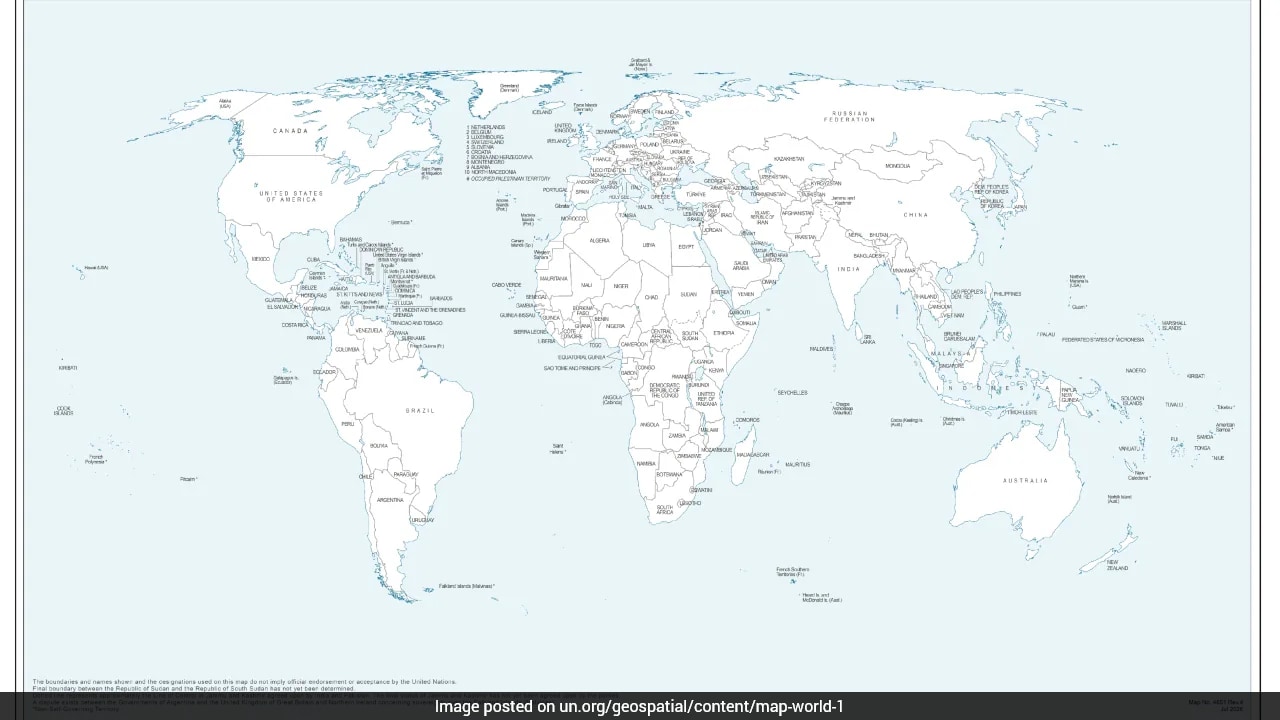
Cartography is rarely just about geography; it is often a silent battleground of geopolitics. When a new world map endorsed during a United Nations General Assembly resolution depicted Arunachal Pradesh and Aksai Chin as regions caught between competing Indian and Chinese claim lines, it immediately ignited a diplomatic firestorm in New Delhi.
If you are wondering why a simple map update has caused such an uproar, you have to look beyond the lines drawn on paper. International bodies like the UN issue geospatial projections for administrative and statistical convenience, but countries with active territorial disputes view every millimeter of border depiction as a high-stakes challenge to their sovereignty.
What Actually Happened at the United Nations
The controversy stems from an African Union-backed resolution titled "Correct the Map," which was adopted by the UN General Assembly. India voted in favor of this resolution because its core intent was to promote equal-area cartographic representations—specifically the Equal Earth projection. Traditional flat maps, like the centuries-old Mercator projection, heavily distort the size of landmasses, making North America and Europe look much larger than African and other developing regions.
India supported this push for equitable cartographic proportions, believing it was a vote for fair geographic sizing. However, the specific world map used during the consultation process came with a major catch. It depicted Arunachal Pradesh and Aksai Chin as distinct territories situated between separate "Indian" and "Chinese" claim lines, while even erasing Arunachal's traditional boundary with Nagaland on that specific projection.
India Response and the Official Stance
The Ministry of External Affairs moved quickly to clarify India's position. New Delhi made it crystal clear that voting for a resolution focused on equal-area mapping does not equate to endorsing any specific depiction of national borders by third-party entities.
The official stance remains uncompromising. India maintains that Arunachal Pradesh and the entire Union Territories of Jammu and Kashmir and Ladakh—including Aksai Chin—are inalienable parts of its sovereign territory. Officials noted that the UN map anomalies were taken up with the relevant departments, stressing that any misleading cartographic output from international bodies is unacceptable.
Why Cartography Triggers Such Intense Reactions
Borders in the Himalayas are heavily militarized and heavily contested. China claims the entirety of Arunachal Pradesh, calling it "South Tibet," while India fiercely rejects this assertion. Similarly, Aksai Chin is a high-altitude strategic plateau controlled by China but claimed by India as part of Ladakh.
When an international organization publishes a map showing these regions as "disputed zones" or separate entities trapped between rival lines, it creates diplomatic ammunition. Even though such UN maps are non-binding, they often quietly bleed into global textbooks, academic databases, and other multilateral institutions. Over time, recurring cartographic shifts can subtly alter international perceptions of a territorial dispute.
Regional leaders in India reacted with sharp criticism, demanding stronger diplomatic pushback to ensure that global bodies do not inadvertently legitimize expansionist territorial claims.
Navigating Global Cartographic Controversies
If you track international relations or geopolitical analysis, you should keep a few practical takeaways in mind when evaluating map disputes:
- Distinguish Resolution Intent from Map Outputs: Always check whether a country voted for a broader technical standard or specifically signed off on a contested graphic.
- Watch the Footnotes: Multilateral bodies often add explanatory notes to controversial borders, detailing that boundaries or lines of control are disputed or agreed upon only up to a certain point.
- Monitor Official Responses: Treat maps published during UN consultations as drafts or working tools rather than formal legal recognitions unless explicitly ratified by member states.
Cartographic battles will continue to flare up whenever global standards clash with national sovereignty. Recognizing the difference between technical map projections and political maneuvering helps cut through the noise.
UN's new world map triggers controversy over depiction of Arunachal Pradesh and Aksai Chin
This video provides a detailed breakdown of the recent United Nations map controversy and how disputed territories like Arunachal Pradesh and Aksai Chin were depicted.
http://googleusercontent.com/youtube_content/1