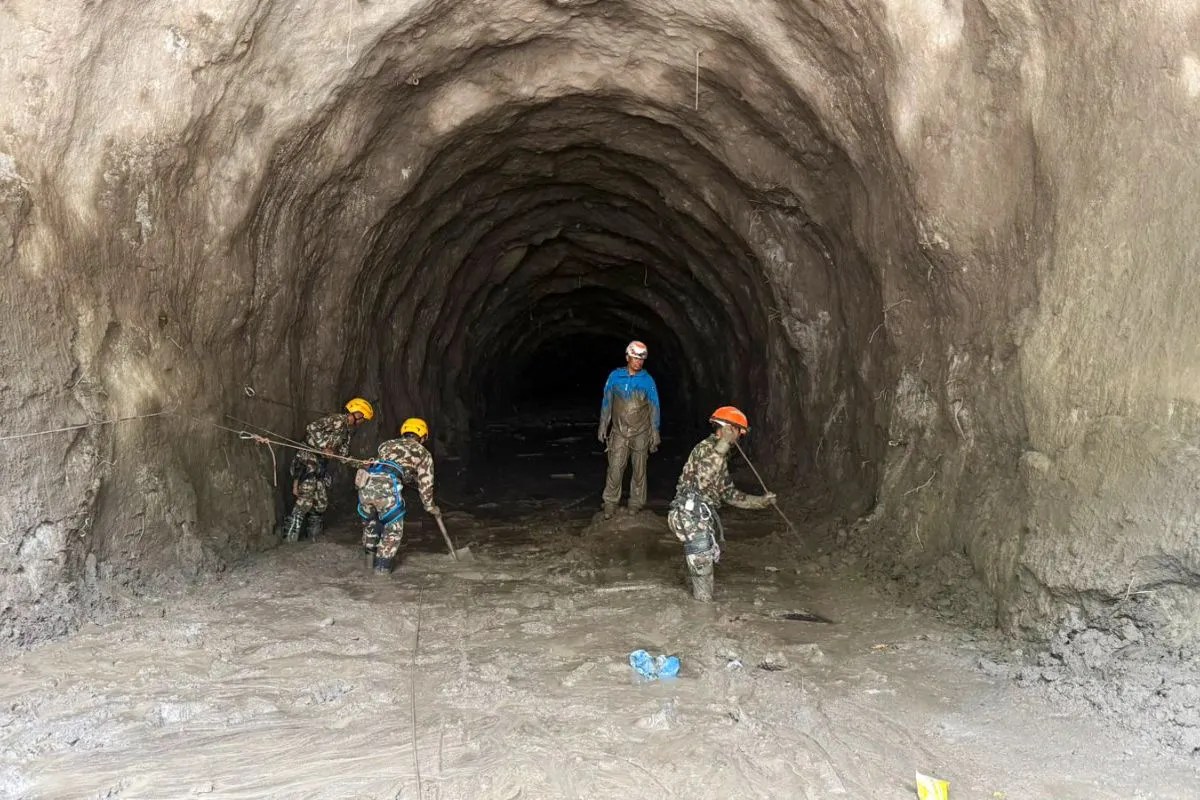
Disaster response doesn't always run on high-tech satellite communications or billion-dollar command centers. Sometimes, it relies on a messaging app pinging away in someone's pocket. When catastrophic floods struck Nepal late last month, leaving massive hydropower projects buried under millions of tons of mud and debris, conventional rescue operations hit an immediate brick wall. Nobody knew where the underground tunnels actually went anymore because the landscape itself had shifted.
Enter a group of five hundred engineers.
What started as an ordinary professional chat group quickly transformed into an impromptu digital lifeline. If you want to understand how modern crises are managed on the ground, look past official press briefings and look at the crowdsourced blueprint sharing happening on mobile phones.
The Underground Maze Created by Flash Floods
When millions of tons of silt, rocks, and mud surge through mountain valleys, they do more than wash away roads. They rewrite geography. In places like the Rasuwagadhi and Upper Trishuli hydropower plants, underground tunnels and powerhouses turned into pitch-black labyrinths.
Rescuers from the Nepalese military faced an impossible puzzle. You can't just send heavy machinery into a mountain slope without knowing what's underneath. The sheer volume of debris—estimated at over twenty-two million tons in the valley—meant that surface entrances were entirely choked off.
Rescue teams needed layouts, structural drawings, and architectural blueprints instantly. They didn't have weeks to dig through paper archives or wait for bureaucratic approvals. That's when the engineering network stepped up.
How a Simple Chat Saved Crucial Hours
The mechanics of this digital rescue operation were brutally efficient. When a government official or field commander needed to know the layout of the Chilime hydropower project, they didn't file an official request. They posted a message in the group asking for layout drawings.
Within minutes, an engineer who had worked on the site years ago would drop structural schematics, cross-sections, and access route maps directly into the chat. This real-time data exchange allowed excavation teams to pinpoint where to dig, avoiding blind guesses that could trigger secondary collapses or waste precious hours.
Former plant employees who knew the underground networks by heart joined the group voluntarily. They began translating confusing surface wreckage into coordinates that underground searchers could actually use. At the Rasuwagadhi plant, rescue teams managed to push two hundred and fifty meters into a tunnel before hitting a massive blockage where nearly forty-six people were suspected to be trapped in an air pocket.
The Reality of Mountain Rescues
People often think that finding survivors after a flood is just a matter of moving dirt fast. It isn't. It's an engineering nightmare.
Military spokespeople pointed out that clearing a blocked tunnel after a disaster is exponentially harder than building one from scratch. The internal pressure, shifting tectonic debris, and flooded chambers mean that every single meter gained requires structural assessment. At the Upper Trishuli-3A project, it took six days just to reach the main entrance buried under suffocating layers of mud. Rescuers had to thread oxygen supply pipes through tiny gaps just to keep potential survivors breathing while they hacked through the sludge.
Stories of survival do emerge against the odds, like workers surviving for over a week underground by sheer willpower and clinging to air pockets. But those saves happen because people on the outside have access to the right technical data the exact second they need it.
Technology in a crisis isn't about fancy gadgets. It's about getting the right schematic into the hands of the person holding a shovel before time runs out.


